Teacher’s Guide
Overview
The goal of this guide is for teachers like you to be able to use uMap to create a site plan that can be used as a map.
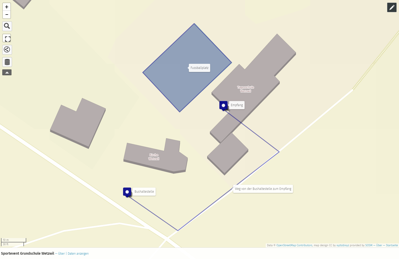
You can see the full example map at https://umap.osm.ch/de/map/sportevent-grundschule-wetzwil_1355#20/47.29694/8.62575. You may have to zoom in on the blue pins.
You will need about 10-15 minutes for the example. Any device with Internet access and the uMap website serve as a means.
|
The international version of uMap is available at https://umap.openstreetmap.fr/de/, but we recommend that you use the Swiss version if your map is in Switzerland. |
What is uMap?
With uMap you can draw your own map on OpenStreetMap background. All drawings and objects are only visible on the map you have created. If you find missing buildings or streets on the map, you can log on to openstreetmap.org and add the missing objects there. Instructions for the online editor of OpenStreetMap can be found at https://gitlab.com/openschoolmaps/openschoolmaps.gitlab.io/-/jobs/artifacts/english/raw/lehrmittel/edit_osm/worksheets_for_students/01_edit_openstreetmap.pdf?job=PDFs.
Instructions for uMap
A school sports event is used as an example.
-
Visit https://umap.osm.ch
-
Select "Create a map"
-
Navigate to the place where you want to create a map, for example your school.
-
Firstly, click on the marker icon
 in the top right corner of the map. You can then place it on the map.
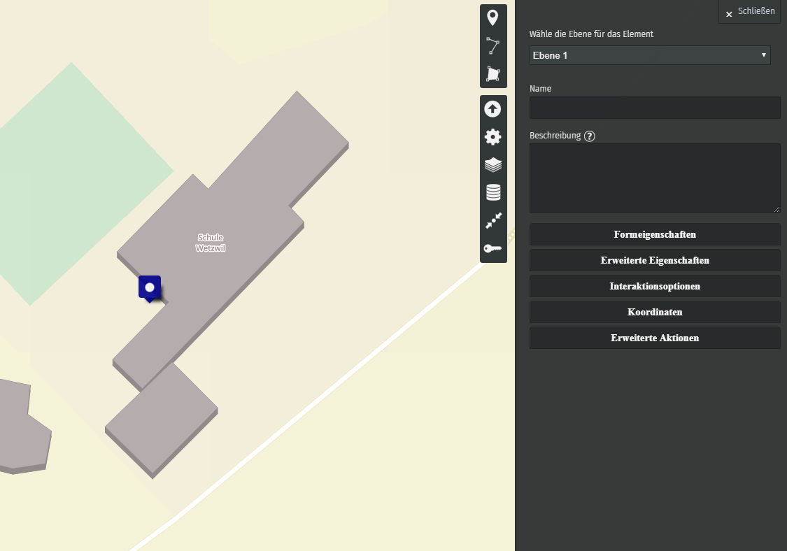 Figure 2. Draw a marker on uMap. Map data © OpenStreetMap Contributors
 -
Secondly, click on the polyline
 It is used to show how visitors get from the bus stop to the event, as seen below.
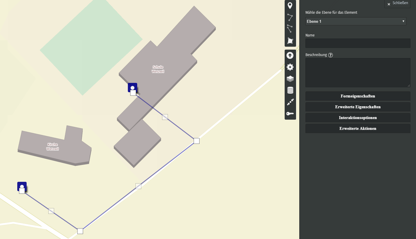 Figure 3. Draw a polyline (e.g. a path) on uMap. Map data © OpenStreetMap Contributors
 -
Thirdly, click on the polygon
 . It is used to represent the area of the sports field.
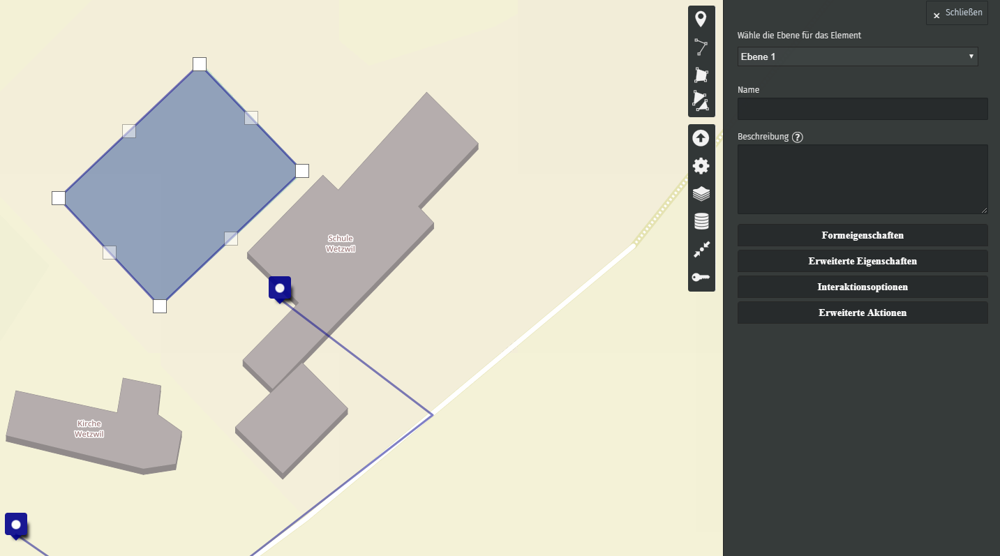 Figure 4. Draw a polygon on uMap. Map data © OpenStreetMap Contributors
If you are satisfied with your site plan, you can click on the "Save" button in the upper right-hand corner. Otherwise, you can leave the editing mode by clicking on the "Disable editing", also at the top right. You have now successfully created your first map with uMap!
uMap and the OpenSchoolMaps project are based on OpenStreetMap (https://osm.org).
| The uMap map editor can do more than this example here. uMap can be embedded in a web page, for example. This and more is explained in the document "OpenStreetMap Resources for Web Developers" https://md.coredump.ch/s/M3HuJuPJi. These are freely available programming resources from uMap to a simple self-written Javascript-based web map that does not require its own server. |
Any more questions? Please contact Stefan Keller (stefan.keller@ost.ch)!
![]() Freely usable under CC0 1.0: http://creativecommons.org/publicdomain/zero/1.0/
Freely usable under CC0 1.0: http://creativecommons.org/publicdomain/zero/1.0/